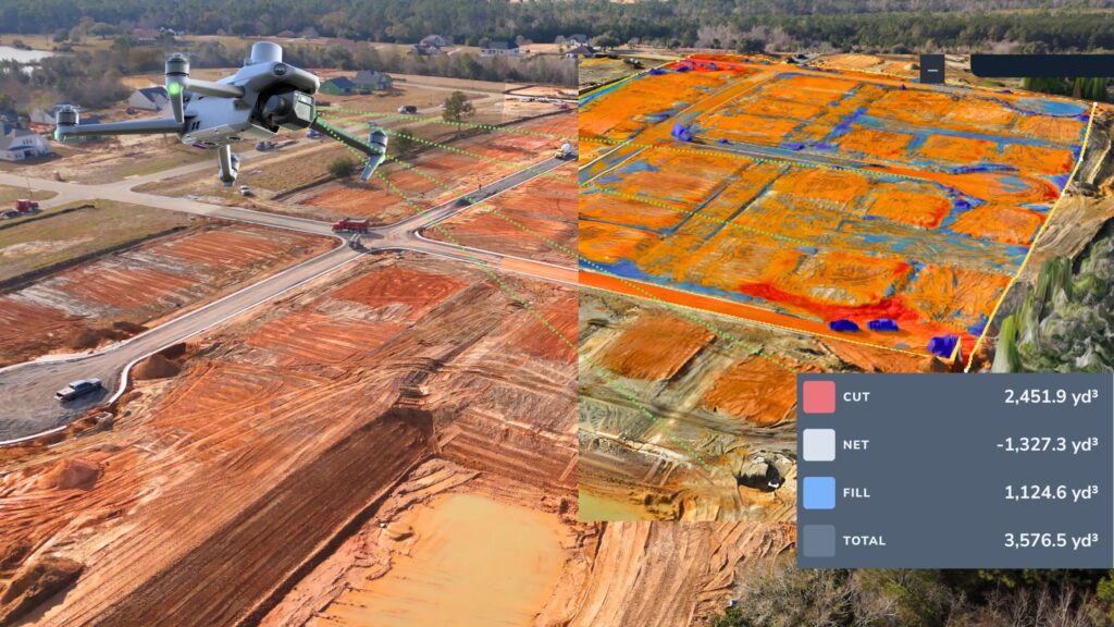
ART X LLC utilizes the latest in drone mapping technology to provide precise aerial surveys of your property. With high-resolution imagery, we can capture detailed topographical data, monitor progress, and create accurate maps of your site. This technology allows us to plan and execute projects more efficiently, while also providing you with valuable insights into your project’s scope.
What We Do:
- Use drones to capture aerial images and map out your site
- Provide detailed, high-resolution topographical data
- Monitor progress and gather valuable insights for project planning
- Offer more efficient surveying and project management